Protect Crops with Intelligence from Drone Images
Skysense helps you stop plant disease and weeds before the damage is done by providing agricultural intelligence from self-flying drones.
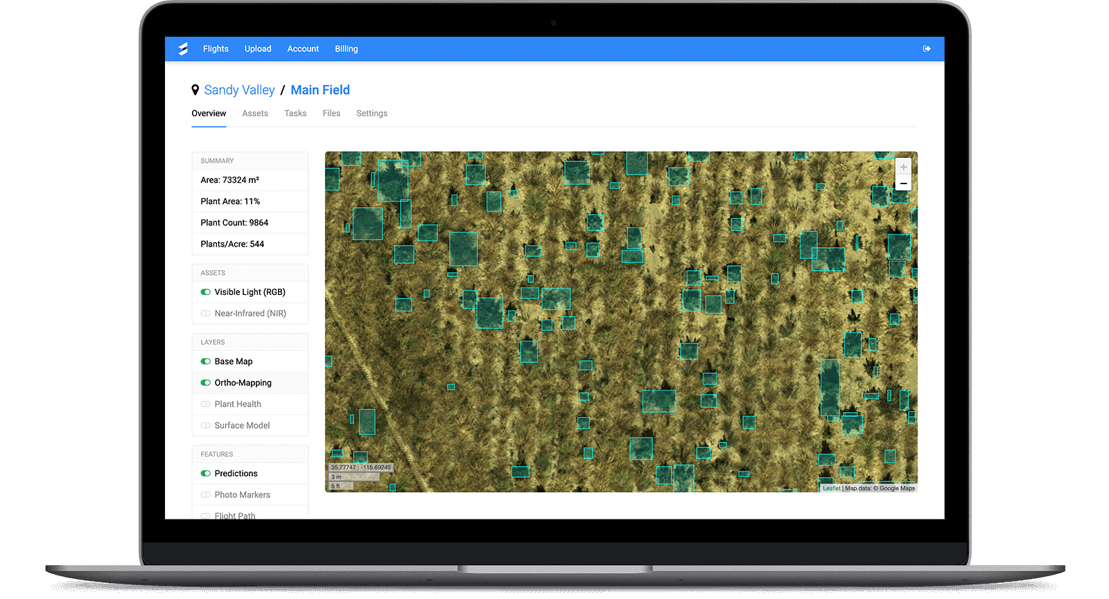
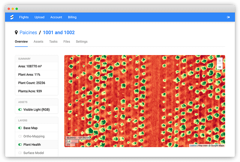
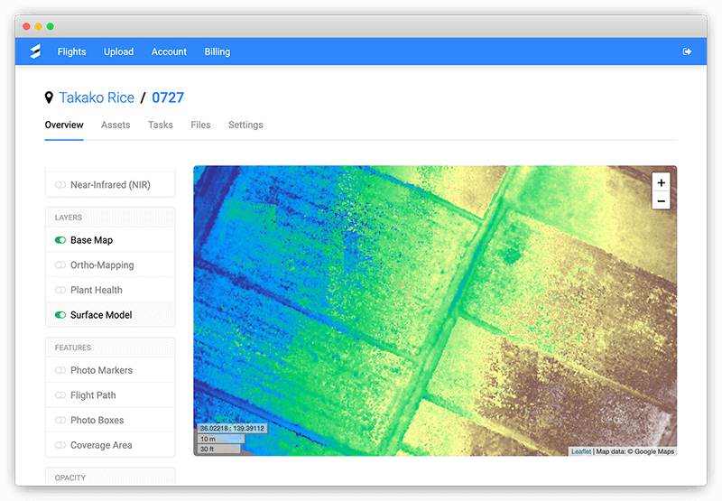
Monitor every plant over time
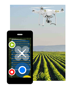
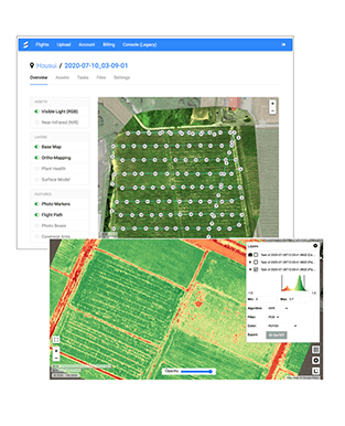
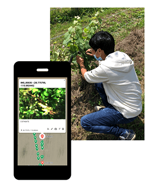
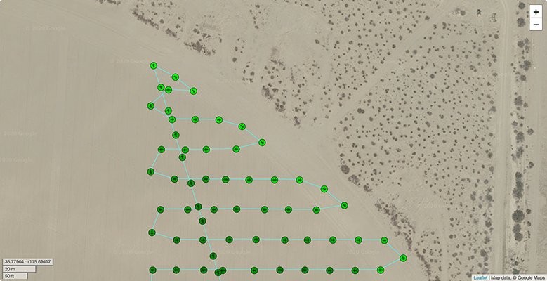
How it works
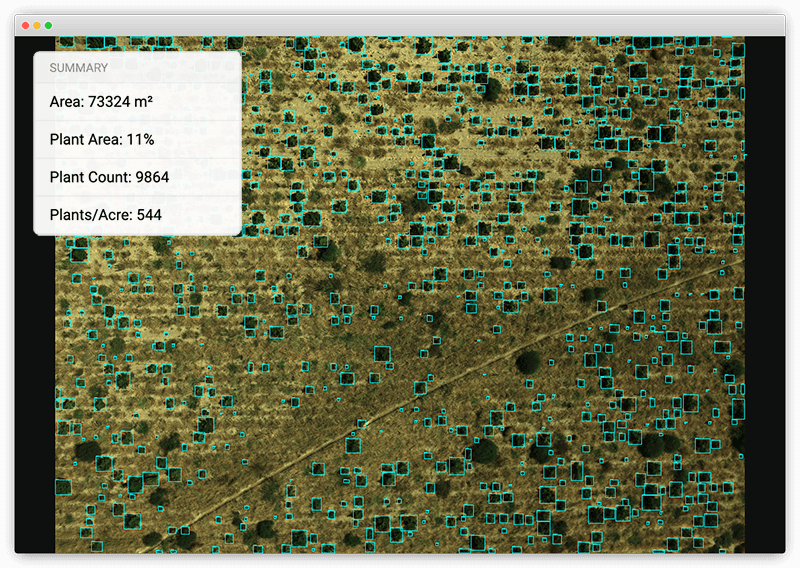
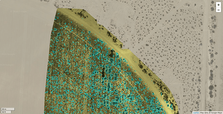
Count Plants
Deep learning AI is tuned to detect and count specific plant species. Count plants and weeds separately, monitor plant growth, and improve insurance claims.
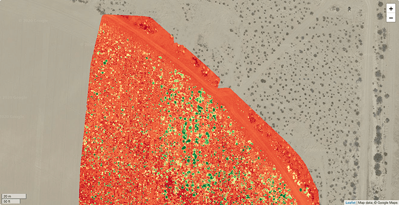
Scout Diseases
Go beyond NDVI-based plant health to classify specific plant diseases. Made possible by applying AI to low-altitude drone flights. Equip the drone fleet with hyper-spectral cameras to maximize the detection accuracy.

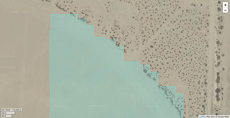
Interact with Maps
Image-based intelligence is embedded in interactive farm maps, that the whole team uses to prioritize labor, optimize spraying, and evaluate experiments.
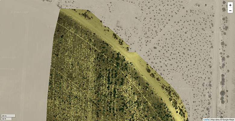
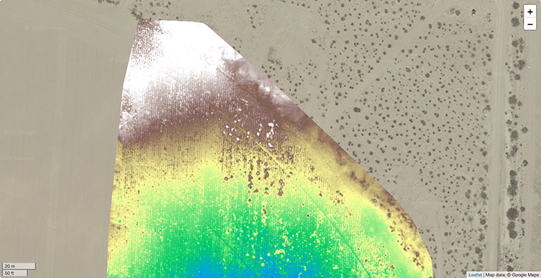
Monitor Health
Spot plant stress early with overlays generated from standard RGB cameras (VARI) and multispectral cameras that capture near-infrared, invisible to the human eye (NDVI).
Generate Surface Models
Improve irrigation decisions by understanding where water flows, using accurate surface models that map your field's 3D topography.
Need our expertise to solve a different problem?
Contact us to schedule a meeting and share details about your unique use case or ideas. Skysense has brought together drones, scientific imaging, and AI for the first time to revolutionize your business.
The Skysense team is excited to solve custom problems together and can take care of all the details from regulations and choice of equipment to developing fully trained deep learning algorithms with custom image annotation.
Contact UsHosting that suits your needs
The Skysense Advantage
Skysense is the first provider of crop diagnostics powered by deep learning AI in Japan.
Backed by industry-leading AI experience and significant venture capital investment, Skysense delivers innovative data solutions that assist in crop stress mapping, disease detection, weed management, irrigation management, and more.
Secure your competitive edge this growing season by using Skysense's unique technology!
Get Started