Power of AI and Satellite Technology for Effortless Land Cover Analysis
Are you tired of manual, time-consuming land cover classification processes? Welcome to Skysense, where cutting-edge drone and satellite imagery combined with powerful AI make land cover classification a breeze. Say goodbye to tedious tasks and hello to efficiency, accuracy, and time savings.
Our Expertise
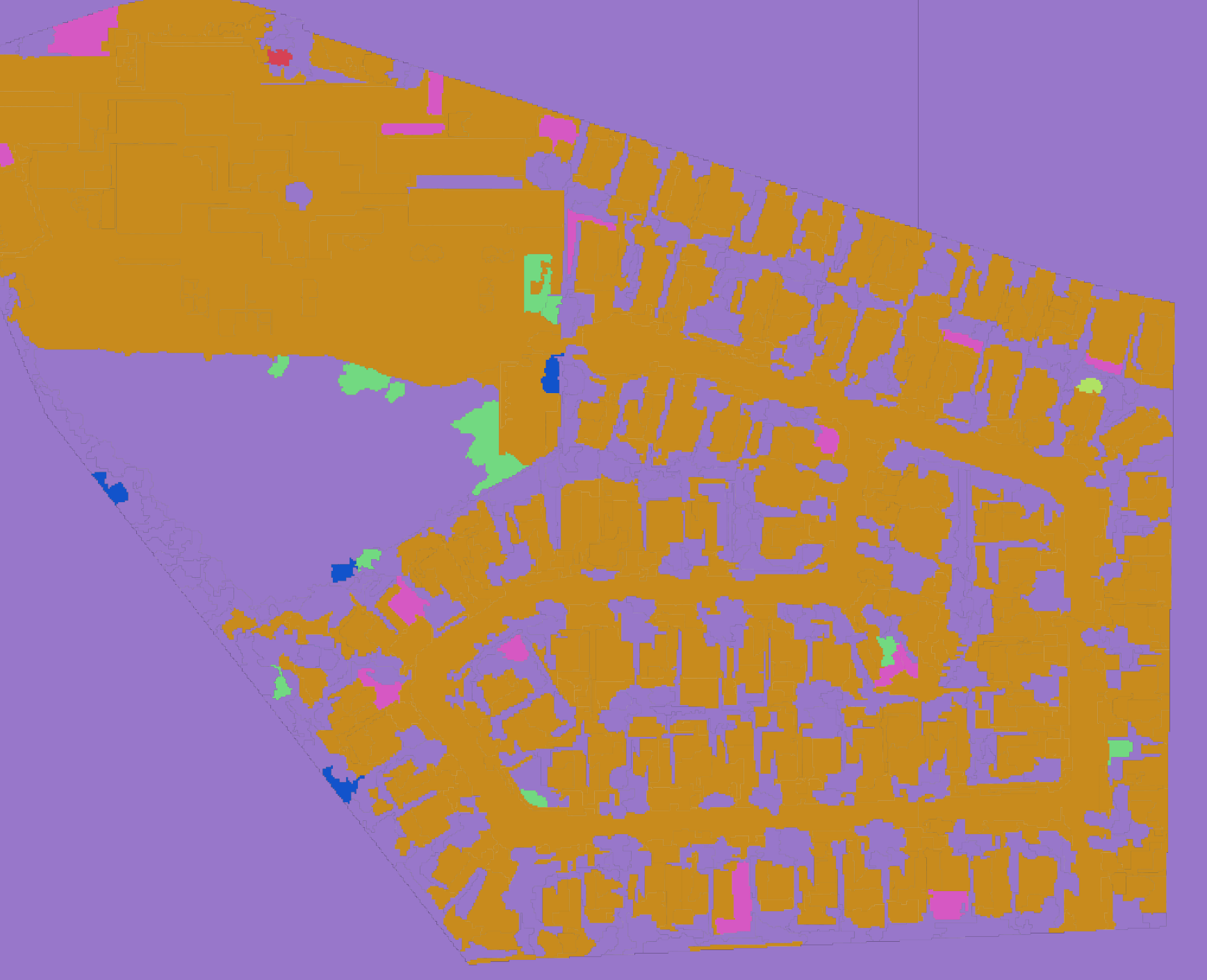
At Skysense, we specialize in leveraging advanced technologies to provide you with comprehensive land cover classification raster images. Whether you need to identify land cover types, distinguish impervious from pervious surfaces, or assess tree canopy cover, our AI-driven solutions are tailored to meet your unique needs.
How It Works
-
Provide Your Boundaries: Simply share your boundary data with us, and we’ll take it from there. Whether it’s a specific area, region, or an entire landscape, our technology can handle it all.
-
Choose Your Imagery: Have your own imagery? Great! Bring it to the table. If not, don’t worry—we can help source high-quality drone and satellite imagery for you. Our extensive network ensures you get the data you need.
-
AI-Powered Analysis: Once we have your data, our state-of-the-art AI algorithms kick in. The power of machine learning enables us to swiftly generate accurate land cover classification raster images, saving you significant time compared to manual methods.
Why Skysense?
-
Time Savings: Say goodbye to the days of spending countless hours on manual land cover classification. With Skysense, the process is streamlined, allowing you to focus on what matters most.
-
Precision and Accuracy: Our AI algorithms are trained on vast datasets, ensuring precise and reliable land cover classifications. Make decisions with confidence, backed by accurate information.
-
Flexibility: Whether you’re working on urban planning, environmental assessments, or any other project requiring land cover analysis, our solutions can be customized to suit your specific goals.
-
Cost-Effective: Traditional methods can be expensive. Skysense offers a cost-effective alternative that doesn’t compromise on quality. Maximize your budget without sacrificing accuracy.
Get Started Today
Ready to experience the future of land cover classification? Join countless professionals who trust Skysense to deliver unparalleled AI-driven solutions. Take the first step towards effortless analysis and informed decision-making.
Get in touch to discuss your project, or explore our website to learn more about how Skysense is transforming the way we understand and analyze land cover. Welcome to a new era of efficiency and accuracy!